


Storm to Bring Heavy, Flooding Rain in Northeast

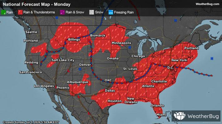
Periods of rain and embedded thunderstorms will occur across parts of southern New England into the northern Mid-Atlantic today into Tuesday. Some of the rain will be heavy at times and could lead to localized flooding concerns.
A slow-moving disturbance will track across parts of the Northeast and northern Mid-Atlantic today into Tuesday causing areas of rain and embedded thunderstorms, some of which will be heavy and could cause flooding issues. Remember if a roadway is flooded, "Turn Around, Don't Drown!". This will likely lead to travel delays across this region of the country.
Rain totals of 1 to 2 inches will be common across eastern Pennsylvania, New Jersey, the Hudson Valley into Long Island in New York, Connecticut, Rhode Island and even parts of Massachusetts. Locally higher amounts of up to 3 to 5 inches will be possible in the heaviest of rainfall.
Flood Watches are in effect across eastern Pennsylvania, New Jersey, parts of New York, Connecticut, Rhode Island and even a small part of southeastern Massachusetts.
Make sure to know the difference between a watch and a warning should they be issued. A "watch" means that conditions are favorable for severe weather to occur, and to be on alert for any rapidly changing conditions. A "warning" means that severe weather is imminent, and you should act fast to remain safe.